info@janessurveying.com // 844.769.7020
Janes Surveying, Inc.
  • Home
  • Locations
    • Palmyra, MO
    • Cameron, MO
    • West Palm Beach, FL
  • Services
    • ALTA Survey
    • Boundary Survey
    • Construction Survey
    • Mortgage Survey
    • Permitting
    • Right of Way Survey
    • Topographic Survey
    • Tree Survey
  • Team
  • Blog
  • Contact

Land Survey

21 October

Land Surveyor

Land Survey, October 21, 2022

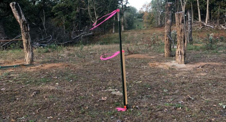
Most people aren’t aware what a land surveyor does or what land surveying is. Surveying is the technique, professions, art and science of determining the terrestrial or three-dimensional position of a point and the distances and angles that are measured between them. This technique is used in order to establish the size of a plot of land and the buildability of it. WHY HIRE JANES AS YOUR MIDWEST SURVEYOR? As a result of 28 years of experience in construction surveying, Janes Surveying, Inc. is your Midwest surveying specialist. We are located in Palmyra, Missouri and licensed to service you in.

Continue Reading

21 October

Property Survey

Land Survey, October 21, 2022

When you’re purchasing a home, there are many different obstacles to overcome. For example, homebuyers may need to get a property survey before they close on their new place. The reason that Property surveys are done is to determine and confirm land boundaries. Examples would be the plot of land a home sits on, and any sub-surface improvements, like a septic tank or well. They also identify other types of restrictions and conditions that apply to the legal description of a property. Whether you’re buying a new home or building an addition onto a property you already own, a property.

Continue Reading

20 September

As-Built Survey

Land Survey, September 20, 2022

As-Built Surveys verify compliance with approved design plans and provide a legacy record for both internal and external use. Frequently, as built surveyors will use precise lasers to determine the measurements. They use these measurements to create a rendering that shows the exact layout and dimensions of the building. Along with the survey you should be considering your punch list to make sure everything actually gets done. As-Built Surveys are necessary during progressive phases of the construction process. This monitors the correct building of the structure as it occurs. Project managers may use this precise information to extend deadlines or.

Continue Reading

20 September

What is a Plat Survey?

Land Survey, September 20, 2022

Plat surveys are used for identifying parcels of land over a large area where precise estimates and boundaries would be too expensive or difficult to carry out. The survey is presented with the same details from the starting point and back again in text, in addition to the visual re-creation of the location. Therefore, when a developer wants to subdivide a large piece of land into smaller plots and parcels, they must go through the statutory process of “plating.” A new residential subdivision’s residential lots, streets, and parks are created from these smaller areas. What is a Plat of Survey?.

Continue Reading

18 August

How to hire a land surveyor?

Land Survey, August 18, 2022

A land surveyor is an individual with the important task of verifying property lines so that you don’t build anything where you are not allowed to. To make these verifications, surveyors go out into the field to search for original property markers on the land (these are usually underground and contain details about who originally surveyed the land). Land surveyors also do a lot of measurements and calculations around the property and the neighborhood. Plus, they search for and review city, county and state property records. How to hire a land surveyor? You should consider whether you want to hire.

Continue Reading

18 August

Why is it important to use a licensed land surveyor?

Land Survey, August 18, 2022

When you purchase a new home or insure your property (auto, home, business, etc.), who do you trust to ensure you are properly protected at close or come claim time? Simple; a licensed realtor and a licensed insurance agent. Why should it be any different when you need your land surveyed? The short answer is that it should not be any different. The long answer is hiring Janes Surveying, Inc. as your Midwest licensed land surveyor should be your first step to ensuring your land (asset) is properly protected for years to come and will hold up if the land.

Continue Reading

16 June

What is a Real-Time Kinematic (RTK) Survey?

Land Survey, June 16, 2022

Real-time kinematic, also known as RTK,  is a surveying technology which measures the relative positions while using two different Global Navigation Satellite System (GNSS) antennas in real-time with better accuracy. The errors found in GNSS results are decided and fixed using RTK technology. The new generation of intelligent RTK systems provide reception of all available satellite signals. Because of this, slope measurement can be taken without centering and calibration increases productivity by 20%. With this high tech technology, it ensures continuation of a RTK survey incase of temporary interruption of correction signal reception. RTK is mainly used for construction applications.

Continue Reading

22 April

How long does it take to get a land survey done?

Land Survey, April 22, 2022

Land surveying is a scientific technique used to determine a property’s points and distances between them. These points are used to create boundaries for ownership and establish land maps. Surveyors use physics, mathematics, engineering and law to establish these land boundaries. The time it takes to get a land survey honestly depends on your type of property and the quality of the existing deeds. A physical survey cannot even begin until surveyors research and review the deeds and plats for the property, then gather information about the properties that surround your land. For instance, some of this information may be.

Continue Reading

21 April

What is a Total Station?

Land Survey, April 21, 2022

What is a Total Station? A modern surveying instrument that integrates an electronic theodolite with an electronic distance meter is called a total station. A theodolite uses a movable telescope to measure angles in both the vertical and horizontal planes. They come in two different types. The first is transit, which rotates in a full circle in the vertical plane. The second is non-transit, rotating in a half-circle. Digital theodolites are great, but total stations are much better. Therefore, not only are they more versatile and accurate, but they can also make you more efficient. Once you measure and log.

Continue Reading

How is a Survey marked?
27 March

How is a Survey marked?

Land Survey, March 27, 2022

A surveyor places survey markers to label major points on the land’s surface. For instance, the surveyor may place survey marks at the northeast and southwest corners of a piece of land to physically represent the boundaries. The legal description for a property, which is the land’s dimensions in words, may reference the placed markers. A property’s legal description is needed for real estate documents such as deeds and mortgages. TYPES OF MARKERS Markers today may come in various forms, including iron pins, but the most common used markers are stakes and flags. In the past, surveyors used less permanent.

Continue Reading

Older Posts
222 South Main Street Palmyra, Missouri 63461
311 N Walnut Street Cameron, Missouri 64429
4546 Cambridge Street West Palm Beach, Florida 33415
© Janes Surveying, Inc.
  • Home
  • Locations
    • Palmyra, MO
    • Cameron, MO
    • West Palm Beach, FL
  • Services
    • ALTA Survey
    • Boundary Survey
    • Construction Survey
    • Mortgage Survey
    • Permitting
    • Right of Way Survey
    • Topographic Survey
    • Tree Survey
  • Team
  • Blog
  • Contact