The Federal Emergency Management Agency, or FEMA, has an online tool that makes it easy to see if your address is in a flood zone. The Flood Map Service Center shows information like flood zones, floodways, and your own home’s risk level. There’s also topographical and infrastructural information about features like levees, coastal barriers, and the base flood line. The map can seem confusing at first until your familiar with it. FEMA maps do undergo periodic updates. You’ll more than likely need to visit the flood center multiple times to receive the most correct data. With new construction and changes.
What is a Subdivision Survey?
Uncategorized, May 23, 2022A subdivision survey may be required when an existing property needs to be divided. This can be for any number of reasons. They include, but are not limited to, estate settlement, mortgage requirements, development purposes, or to sell a portion of your property. To prepare a subdivision survey correctly, a boundary survey should be performed first to verify the dimensions and acreage of the original property. A subdivision survey can also be referred to as subdivision platting. Subdivision platting is the process of splitting a tract of land into smaller parcels. The survey is completed when an owner desires to.
How long does it take to get a land survey done?
Land Survey, April 22, 2022Land surveying is a scientific technique used to determine a property’s points and distances between them. These points are used to create boundaries for ownership and establish land maps. Surveyors use physics, mathematics, engineering and law to establish these land boundaries. The time it takes to get a land survey honestly depends on your type of property and the quality of the existing deeds. A physical survey cannot even begin until surveyors research and review the deeds and plats for the property, then gather information about the properties that surround your land. For instance, some of this information may be.
What is a Total Station?
Land Survey, April 21, 2022What is a Total Station? A modern surveying instrument that integrates an electronic theodolite with an electronic distance meter is called a total station. A theodolite uses a movable telescope to measure angles in both the vertical and horizontal planes. They come in two different types. The first is transit, which rotates in a full circle in the vertical plane. The second is non-transit, rotating in a half-circle. Digital theodolites are great, but total stations are much better. Therefore, not only are they more versatile and accurate, but they can also make you more efficient. Once you measure and log.
How is a Survey marked?
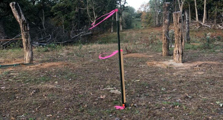
Land Survey, March 27, 2022A surveyor places survey markers to label major points on the land’s surface. For instance, the surveyor may place survey marks at the northeast and southwest corners of a piece of land to physically represent the boundaries. The legal description for a property, which is the land’s dimensions in words, may reference the placed markers. A property’s legal description is needed for real estate documents such as deeds and mortgages. TYPES OF MARKERS Markers today may come in various forms, including iron pins, but the most common used markers are stakes and flags. In the past, surveyors used less permanent.
When should you have your land surveyed?
Land Survey, March 27, 2022If you’re going to be selling or buying land, it’s a good idea to make sure it’s been surveyed recently. An up-to-date and accurate survey of the land will make certain that the legal property lines listed on the deed are correct, and any discrepancies between neighboring land owners can be addressed promptly. Most lenders and buyers will want a recent, updated land survey before the purchase. When changes are made on your land or your neighbor’s property, the old survey will become unreliable. It’s possible that things such as a new fence to an added deck, pool, building or.
What is a Tree Survey?
Uncategorized, January 16, 2022Tree location surveys are an assessment of the different types of trees on a forested piece of land that is currently under consideration for development. If you are going to build on land or landscape an area and your project will require the removal of several trees, you’ll need a trusted Arborist to perform a tree survey. This is a necessary step for you to take before you can start clearing out the land in question and begin working on your property development project. Typically, a tree survey will provide the landowner with an idea of the tree type and.
What is a Topographic Survey?
Uncategorized, January 16, 2022Typically, a topographic survey would be required during new construction, remodeling projects, road or bridge construction, and grading projects. Before any construction can begin on a piece of land, a topographical survey is most likely needed. This can also be known as a land or ground survey. This specific type of survey identifies and locates both the man-made and natural features on the property, giving all parties working on the job a reference point from which to start. When you order a topographic survey from Janes Surveying, Inc. in Midwest, it will depict all natural features and elevations of your.
What is Permitting?
Land Survey, January 15, 2022A permit is a formal document issued by the city or county and is required for most construction or remodeling projects. Therefore, it is important to obtain the proper permit before starting your next building project. For instance, securing land use permits ensures that current or proposed land uses consider all viable factors. These factors include the environmental constraints, population density, commerce, traffic and roadway capacities, storm water management, utility availability and general benefit of the land’s (potential) use. Janes Surveying, Inc. specializes in residential permitting, commercial permitting, and general permitting. You have our guarantee that we will put our.
What is a Right-of-Way Survey?
Land Survey, November 9, 2021A right-of-way survey in the Midwest is used to determine any rights that could be held on your property by public or private ownership. Why would a public or private ownership require use of your property in the Midwest? Think of a utility company that needs access to their power lines or gas line that runs through your property. A right-of-way is necessary on your property for the companies to access their property, which is permitted by law. Oftentimes referred to as easements, right-of-way agreements are very common throughout the Midwest and normally only reflect a section of land containing.


